
Two pre-event seminars led by expert instructors, offering in-depth learning and practical insights ahead of the main program.
Greenfields Prediction in 4D: From Global- to Camp-scale
Introduction to Interpreting Drilled Assay Data as Structural Patterns
The Use of Mineral System Science to Drive Critical Mineral Exploration in the Kingdom
Graham Begg
Dr. Jun Cowan
Dr. Frank Bierlein & Dr. Honza Catchpole
1.5 Hours &
20 Mins Q&A
1.5 Hours &
20 Mins Q&A
1.5 Hours &
20 Mins Q&A
Geophysics Applied to Mineral Exploration
Dr. Sergio Espinosa and Dr. David Khoza
4 Hours
Exploration geoscience is experiencing a revolution that is moving it from a reactive empirical approach to a proactive predictive approach that will drive the next wave of discoveries. Mineral Systems are the new paradigm for understanding ore genesis, connecting whole-lithospheric structure and history with geodynamics, shifting the focus from near-deposit observation to the mapping of multi-scale processes. Technological advancements have delivered the ability to map the Earth in 4D. Whole mantle convection in the form of subducted slabs and mantle plumes are being imaged and mapped, and supercontinent cycles are being reconstructed. And we are making major progress mapping the structure of the entire lithosphere and its connection to Plate Tectonic events.
Magmatic Ni-Cu-PGE deposits, generated in a perfect storm of plume-driven melting focused by 3D lithospheric structure, favourable geodynamic conditions and lithospheric contamination are an obvious example of the multi-scale processes. Porphyry Cu deposits are now linked to hydrous magmas generated deep in compressive arc segments rather than shallow-crustal magma chambers, and gold deposits are linked to low-degree partial melting of metasomatized mantle domains triggered by geodynamic drivers. Converting these understandings to spatial prediction has placed a premium on understanding lithospheric architecture and when and where it will focus the causative mineral systems. Recognition that ancient lithospheric structure can play a key role in localising the resultant ore deposits is one new insight.
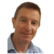
Graham Begg has over 30-years of experience in the mining and minerals exploration sector, and since 2002 he has spearheaded collaborative research aimed at systematic multi-disciplinary mapping of the architecture and geodynamic evolution of the continental lithospheric mantle and crust. The outputs are contained within the industry-leading commercial Global Lithospheric Architecture Mapping (GLAM) product, aimed at facilitating a breakthrough in greenfields exploration discovery.
Virtually all resource geologists and geostatisticians view 3D grade distribution as meaningless patterns that can only be defined by variograms, but they are actually structural geological patterns.
This workshop teaches the basics of how to unravel and understand these patterns so that more intelligent exploration decisions can be made and more accurate resource estimations.

Dr. Jun Cowan, the conceptual founder of Orefind, has analysed more than 1,000 drilling datasets globally. Now, 25 years on, he shows you how to interpret drilling data without relying on 3D interpolation—just your eyes, your brain, and a solid grasp of pattern recognition. It’s a return to fundamentals that anyone can start from—essential knowledge before you open any software.
The Proterozoic Arabian Shield covers an area of ~600,000 km2 in western Saudi Arabia, and hosts an extensive range of gold, base metal and critical element (e.g. Li, Ta, Cs, REE) deposits and occurrences. The region remains highly prospective for the discovery of world-class deposits, with new and recently acquired multi-disciplinary datasets (e.g. pre-competitive data made available by the Saudi Geological Survey and the ongoing Regional Geological Survey Programme) providing valuable tools and ‘mappable’ criteria that can facilitate effective exploration targeting. A key to the successful application of targeting criteria is a comprehensive understanding of the mineral systems concept and its application to the Arabian Shield.
In this seminar, we will provide an overview of the mineral systems science framework, discuss the formation and anatomy of a range of representative ore deposit types (e.g. orogenic, epithermal and intrusion-related gold; porphyry copper and volcanogenic massive sulphide copper-lead-zinc; rare-earth element-hosting felsic intrusions and carbonatites; Li-Cs-Ta-Rb pegmatites) through the lens of a mineral systems approach, and review relevant exploration criteria aimed at targeting and discovering critical commodities in the Arabian Shield.

Dr. Frank Bierlein is an exploration geologist with over 30 years of experience as a consultant, company director, technical advisor, researcher, lecturer and industry professional. He has held exploration and generative geology management positions with QMSD Mining Co Ltd, Qatar Mining, Afmeco Australia and Areva NC, and consulted for, among others, Newmont Gold, Resolute Mining, Goldfields International, Freeport McMoRan, and the International Atomic Energy Agency.
Frank has worked on six continents spanning multiple commodities, and over the course of his career has also published and co-authored >150 articles in peer-reviewed scientific journals, book chapters and extended conference papers. He has extensive experience in all aspects of grass roots to mine-stage mineral exploration, target generation, SWOT analyses, project management and oversight, due diligence studies, mineral prospectivity analysis, metallogenic framework studies, and mineral resources market & investment analysis. He was involved in the discovery of the first confirmed porphyry Cu-Au deposit in the Arabian – Nubian Shield (Jebel Ohier) and has worked on several gold and VMS deposits in Sudan, Ethiopia and the Kingdom of Saudi Arabia. In collaboration with the SGS and industry partners, Frank has managed and led exploration targeting programs in the Middyan, Muhadad, Jabal Sayid, Ash Shizm and Wadi Shwas mineral belts, including conceptual (minerals system analysis) and field-based regional to deposit-scale assessments.
Frank obtained a PhD (Geology) from the University of Melbourne, is a Fellow of the Australian Institute of Geoscientists (AIG), and a member of both the Society of Economic Geologists (SEG) and the Society of Geology Applied to Mineral Deposits.
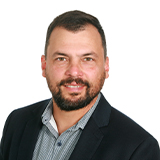
Dr. Honza Catchpole is an exploration geologist with a strong background combining Applied Geoscience with effective exploration management and project execution. He has over 15 years of experience working for major and junior exploration/mining companies in Mexico, USA, Canada, Andean South America, and Europe. He has extensive experience in early- to advanced-stage mineral exploration of porphyry Cu, skarn (Zn-Pb-Ag-Cu), epithermal precious (Au-Ag) and base metal (Ag-Zn-Pb-Cu) deposits, as well as VMS, intrusion-related gold deposits, and phosphate deposits.
Honza has recently been involved in critical- and precious metal prospectivity studies and exploration projects in the Kingdom, and has a strong understanding of mineral system science and metallogenesis in the Arabian Nubian Shield and how it ties with modern exploration techniques.
He held positions at Teck Resources Limited, Sumitomo Metal Mining Canada and Vale Exploration Canada working in project generation, exploration management and project evaluation. He held the position of Vice President of Exploration with GR Silver Mining Ltd, where he was responsible for advancing precious metal exploration activities of large project teams in the larger Rosario mining district in Sinaloa, Mexico.
Honza received his PhD in Earth Sciences from the University of Geneva, Switzerland and is registered as a Professional Geologist (P.Geo) in British Columbia, Canada.
During the four-hour workshop, participants will explore the physical principles behind geophysical techniques used in mineral exploration. They will also learn about the energizing fields employed to illuminate the surface and, especially, the subsurface of the Earth, enabling the mapping of primary and secondary physical properties of geological volumes at various depths and resolutions.
Attendees will gain insights into how the energized field or subsurface response is assessed and quantified using specialized instrumentation. They will also learn how the measured data is processed in 2D and 3D to develop and maintain integrated common earth models.
Finally, through a hands-on practical exercise, they will discover how measured and processed geophysical data, along with calculated 3D models of physical properties, can be geologically interpreted. These models will be examined in the context of identifying and targeting different types of ore deposits."
9:30
9:55
10:05
10:15
10:35
10:55
11:20
11:35
11:55
12:15
9:55
10:05
10:15
10:35
10:55
11:20
11:35
11:55
12:15
13:25
25 min
10 min
10 min
20 min
20 min
25 min
15 min
20 min
20 min
1 hr 10 min
Introduction to Geophysics Applied to Mineral Exploration
Surface Mapping: Remote Sensing (Radar)
Surface Mapping: Remote Sensing (Optical)
Surface Mapping: Radiometrics
Depth Imaging: Potential Field Techniques Gravity
Depth Imaging: Potential Field Techniques Magnetics
Break
Depth Imaging: Wave Techniques Electromagnetics (EM)
Depth Imaging: Wave Techniques Seismology & Seismics
Practical Exercise using Remote Sensing, Radiometrics, and Magnetics
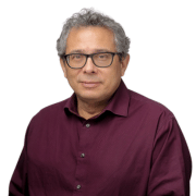
Dr. Sergio Espinosa has nearly 30 years of global experience as a mineral exploration geophysicist, having worked across the Andes, the North American Cordillera, Central America and the Caribbean, the Canadian Shield, Scandinavia, West and Central Africa, and the Middle East. He specializes in the full suite of geophysical techniques for mineral exploration using both airborne and ground platforms, with particular expertise in Magnetics, Gravity, and Electromagnetics.
He earned his BSc, MSc, and PhD in Applied Geophysics in Engineering and Exploration from the prestigious TU Bergakademie Freiberg (School of Mines) in Germany. He also conducted postdoctoral research at the Freie Universität Berlin and the Helmholtz Centre Potsdam (GFZ) German Research Centre for Geosciences.
Over the years, Sergio has worked with and consulted for leading companies such as BHP, Placer Dome (now Barrick), Ivanhoe Mines, and Goldcorp (now Newmont), where he most recently held the role of Geophysics Director. His project work spans a range of deposit types, including porphyry, high- and low-sulfidation epithermal, skarn, volcanogenic massive sulfide, banded iron formation, IOCG, orogenic gold, and sediment-hosted copper deposits.
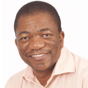
Dr. David Khoza is a geophysicist who has worked in the minerals exploration, mining and geoscience research. David joined BHP Billiton’s mineral exploration division in 2006 conducting geophysical surveys primarily in Africa.
David then went back into academia to complete his PhD, which focussed on understanding the tectonic evolution of the Southern African lithosphere using magnetotelluric data. Following that, he joined Anglo American’s Technical Solutions department supporting several business units in mining, green and brownfield exploration and research efforts. He then joined SPECTREM AIR, primarily focused on airborne data processing, modelling, interpretation and research. David then joined Council for Geoscience’s Executive Management Team until May 2023 responsible for implementing the mapping programme.
David is currently the Technical Director at Integrated Geoscience Solutions, a South African-based firm doing consulting and geoscience research for minerals and energy exploration, groundwater mapping and environmental sectors. He holds a BSc (Geology and Physics), BSc Honours (Geophysics) and a PhD (Geophysics) from the University of the Witwatersrand.


